
The Laguna Niguel Trail Network: How 80+ Miles of Connected Greenbelt Quietly Adds Value to Your Home

There is a moment that sells the Laguna Niguel trail system. You walk out your front door, cross one street, and you are on a connected greenbelt that takes you to the ocean if you want it, or up into the canyon hills if you prefer. No car. No drive. No parking lot. The trail begins where the sidewalk ends.
The city was designed around this. Eighty-plus miles of connected pathways link the inland canyon systems to the coast through one of the most thorough greenbelt networks in coastal Orange County. Most relocating buyers do not realize how much of their daily lifestyle this actually shapes until they live with it for a few months.
The other thing most buyers do not realize is that this is not just a lifestyle feature. Laguna Niguel greenbelt access is a real value driver, and the trail homes that plug directly into the network tend to outperform comparable homes a drive away on long-term resale. This piece maps the major Laguna Niguel hiking trails, identifies which neighborhoods sit on the network and which sit near it, and explains why this should weigh more in your location decision than buyers usually let it.
| Value | What It Tells You |
|---|---|
| 80+ Miles | Approximate length of the connected Laguna Niguel trail and greenbelt network |
| 5 Major Systems | Aliso Creek, Salt Creek, Badlands, Crown Valley, and Niguel Hills are all linked |
| Direct Access | The feature that quietly outperforms in long-term resale |

Why the Laguna Niguel Trail Network Matters for Value
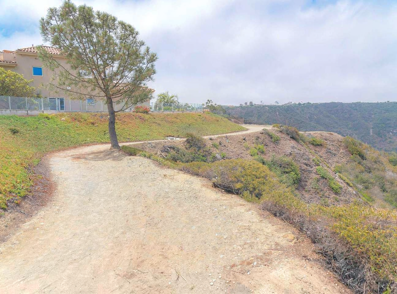
The value impact of Laguna Niguel trails is structural rather than incidental, and it comes from three reinforcing reasons.
The first is connectivity. The Aliso Creek trail, the Salt Creek trail, and the Niguel Hills system link into each other and into the regional park network, which means you can walk or ride for miles without crossing a major road. That continuity is rare in coastal California trail communities, and it is not easily replicable elsewhere in the county.
The second is that the trail adjacent homes serve more buyer profiles simultaneously. The downsizer who wants a daily walk. The relocating family who wants kids on the trails after school. The active retiree. The remote worker who needs a midday break that is not at a Starbucks. A home that serves multiple buyer profiles trades faster, holds value better, and attracts deeper offers when listed.
The third is a fixed supply. The trails were built into the city's planning decades ago. The neighborhoods that plug directly into them are not going to expand, and the access points are not going to multiply. That scarcity is the part buyers underrate at offer and pay for at resale.
"Trail access is the quiet feature buyers under-price at offer and pay for at resale. In Laguna Niguel, it is one of the highest leverage decisions you can make on location."Susan Chase, Living in Coastal OC
The Major Laguna Niguel Hiking Trails, Mapped
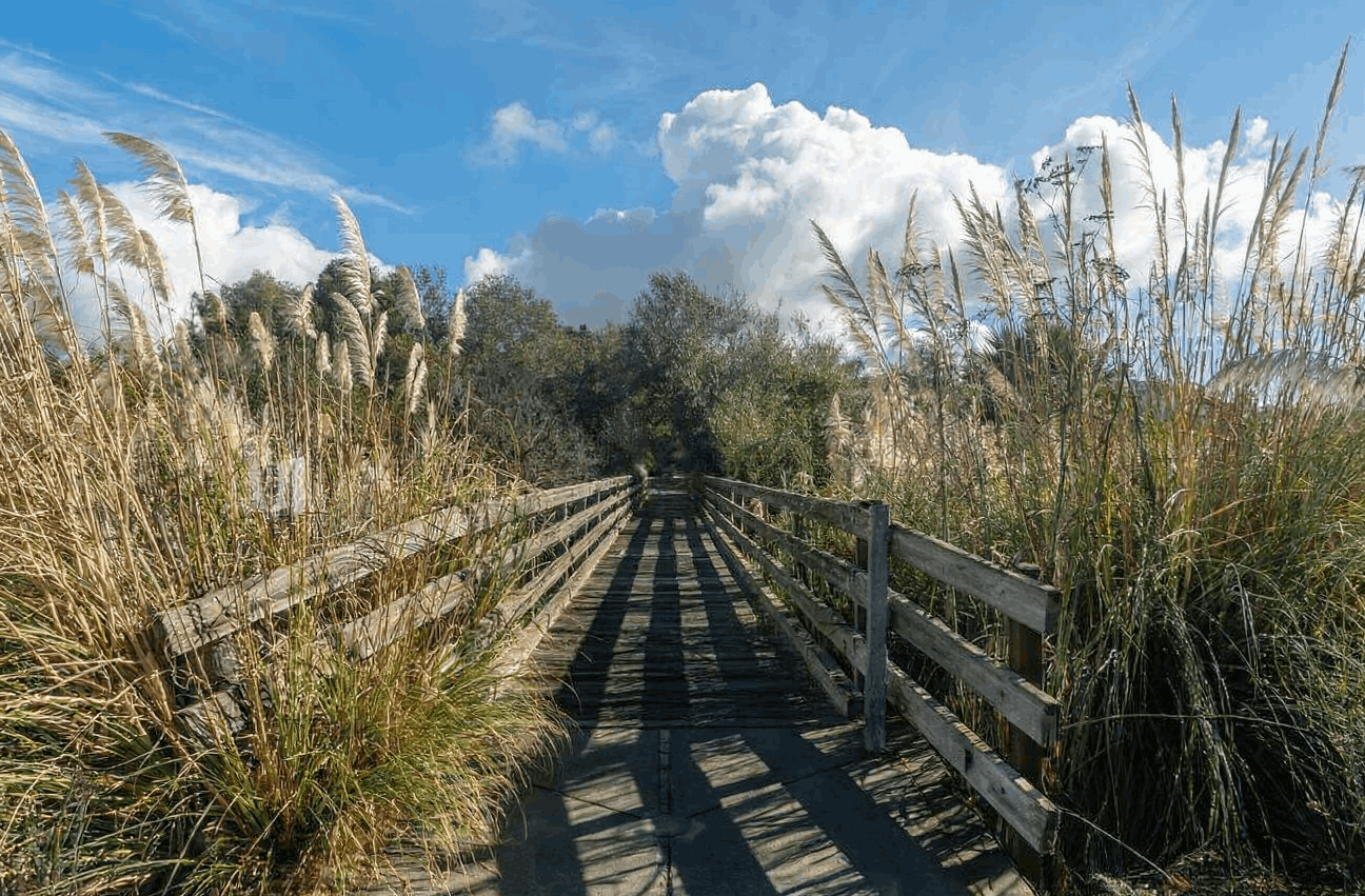
Five trail systems define the Laguna Niguel hiking and walking experience. They connect at multiple points, which is what makes the network function as a network rather than a set of isolated paths. Knowing what each one does is the foundation of any serious location search inside this city.
| Trail System | What It Connects | Best For |
|---|---|---|
| Aliso Creek Trail | Aliso and Wood Canyons Wilderness Park is inland from the coast at Aliso Beach | Distance walking and cycling, regional park connections, full inland to coast traverse |
| Salt Creek Trail | The Niguel Hills corridor down to Salt Creek Beach and Dana Point Harbor | Coastal access on foot, ocean view walking, finishing at the sand |
| Badlands Park Trails | The Bear Brand area and adjacent ridge corridors | Short walks, dramatic ridge and ocean views, Badlands Trail homes access |
| Crown Valley Greenbelt | Parallel paths along the Crown Valley Parkway corridor | Easy paved walking, daily commute alternatives, neighborhood connectivity |
| Niguel Hills Trails | Interior hillside trails linking multiple neighborhoods and parks | Loop walks, elevation, varied terrain inside the city |
Which Neighborhoods Plug Directly Into the Trails
Direct access is the part that matters for value. These Laguna Niguel trail homes do not require a drive to a trailhead. The greenbelt opens at the edge of the neighborhood, and in some cases at the edge of the backyard.
| Neighborhood | Trail Connection |
|---|---|
| Niguel Shores | Direct Salt Creek corridor access on foot to Salt Creek Beach |
| Bear Brand | Adjacent Badlands Park trails plus ridge corridors and beach connections |
| Marina Hills | Aliso Creek trail connections through interior greenbelt paths |
| Niguel Summit | Interior Niguel Hills trail access from within the community |
| Crown Cove and Crown Valley Corridor | Crown Valley greenbelt path access along the parkway corridor |
| Niguel Hills Neighborhoods | Direct entries to the interior hillside trail loop system |
Which Neighborhoods Are a Drive Away
Not every Laguna Niguel address sits on the trail network. Several established residential areas are excellent neighborhoods that simply require a short drive to a trailhead rather than direct access. These are not bad locations, they are just different propositions on this specific feature.
| Neighborhood Profile | Trail Reality |
|---|---|
| Interior Tract Subdivisions | Quiet residential interior streets that require a short drive to the nearest major trailhead |
| Older Inland Sections | Some inland Laguna Niguel pockets sit further from the connected greenbelt entries |
| Condominium Communities Without Trail Edge | Several condominium communities are excellent for other reasons but do not connect to the network |
| Newer Infill Developments | Some recent infill is located between the major systems rather than adjacent to one of them |
How Trail Access Translates Into Long-Term Value
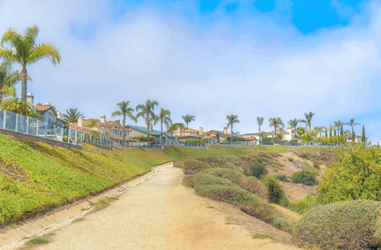
The mechanism is straightforward. Trail direct homes serve more buyer profiles, the supply is fixed by city planning, and the lifestyle pull is hard to replicate elsewhere in the county. Through the current cycle, trail direct homes in Laguna Niguel have tended to hold a quiet pricing premium and recover faster from market dips than comparable homes a drive away. The premium is not dramatic in any single transaction. It compounds over years and across resale cycles.
For relocating buyers and long term holders, this is the part of a Laguna Niguel location decision that pays back the most. The cottage in a tract subdivision and the cottage backing to the Aliso Creek greenbelt are different products at resale, and the gap widens over time. Greenbelt home values in this city have moved together with the broader market on the way up, and held more durably on the way back through soft cycles.
What to Look For When Touring
If you are touring with trail access in mind, the questions below will tell you what you actually have, separately from how the listing markets it.
| Topic | What to Verify |
|---|---|
| Distance to Trailhead | Walk it yourself. Front door to trail entry, in minutes, on foot |
| Quality of the Access | A dedicated greenbelt opening versus crossing a busy parkway changes the daily experience |
| Trail System Connectivity | Confirm the trail at the property links into the broader network rather than dead-ending |
| Backyard Greenbelt Edge | Backing directly to the trail is the strongest form of access and carries the strongest premium |
| HOA Trail Rights | In some communities, trail access is community-owned and rules govern its use |
| Resale Comp Set | Compare trail direct comps against tract interior comps in the same community, not blended averages |
Frequently Asked Questions
Quick Facts
| Category | Description |
|---|---|
| Network length | Approximately 80 or more connected miles across the Laguna Niguel greenbelt |
| Major systems | Aliso Creek, Salt Creek, Badlands, Crown Valley, and Niguel Hills are all linked |
| Direct access neighborhoods | Niguel Shores, Bear Brand, Marina Hills, Niguel Summit, Crown Cove corridor, Niguel Hills |
| Coastal connection | Salt Creek and Aliso Creek trails both lead to the ocean beaches on foot |
| Resale impact | Trail direct homes hold quiet pricing premiums and recover faster through soft cycles |
| Highest premium | Properties that back directly to the greenbelt edge carry the strongest trail value |
A Final Word from Susan Chase
The Laguna Niguel trail system is one of the things long-term residents value most, and relocating buyers most often discover after closing rather than before. The homes that plug into it carry a quiet but durable advantage at resale, and the choice to weigh greenbelt access in your search is one of the highest leverage decisions you can make on location inside this city.
If you are searching in Laguna Niguel and want a route through the trail, direct neighborhoods rather than a general MLS sweep, I am happy to walk you through the network in person and pull comp sets that isolate the access premium rather than blend it. The right home on the trail network is rarer than the listing photos make it look, and the homework is worth doing before you write the offer.
Living In Coastal OC is the editorial home of Susan Chase and the Susan Chase Group at Compass, serving buyers, sellers, and relocations across Laguna Beach, Dana Point, Laguna Niguel, San Clemente, and San Juan Capistrano. For private consultations, neighborhood tours, or relocation guidance, contact us at livingincoastaloc.com.

Susan Chase Group | Compass
Dana Point, California
949-370-6950
susan.chase@compass.com
livingincoastaloc.com
🙋🏼♀️ I’m Susan Chase, your South Orange County Realtor, advisor and guide, helping buyers, sellers, and relocations right-size and find a coastal home and lifestyle they’ll love. ❤️
Sources & Data Verification Laguna Niguel trail network length, connected greenbelt structure, and the major trail systems including Aliso Creek, Salt Creek, Badlands Park, Crown Valley, and the Niguel Hills interior trails: City of Laguna Niguel parks and recreation resources; cityoflagunaniguel.org trail and open space references; OC Parks Aliso and Wood Canyons Wilderness Park resources. Trail to coast connections including Salt Creek trail to Salt Creek Beach and Aliso Creek trail to Aliso Beach: ocparks.com regional park system; City of Laguna Niguel community resources. Neighborhood trail adjacency profiles for Niguel Shores, Bear Brand, Marina Hills, Niguel Summit, the Crown Cove and Crown Valley corridor, and the Niguel Hills neighborhoods: respective community and HOA references; cityoflagunaniguel.org neighborhood profiles; Laguna Niguel brokerage neighborhood guides, 2025 to 2026. Long term resale strength and the trail direct pricing premium relative to comparable homes a drive away: aggregated public listing data and California Regional Multiple Listing Service (CRMLS) Laguna Niguel transactions, 2025 to 2026; OC REALTORS local market reports; Susan Chase Group transaction records. All trail mileage references, neighborhood access characterizations, and resale premium patterns in this article are presented as directional and approximate, based on city resources and 2025 to 2026 market activity, not guaranteed conditions for any specific property. Trail routes, access points, and HOA trail rules vary by property and change over time. Confirm current trail access, current HOA documents, and a trail specific comparative market analysis with a licensed local agent before making a purchase decision.
Categories
- All Blogs (160)
- 2026 Harbor & Coast Reports (3)
- Coastal OC Lifestyle (16)
- Guides (17)
- Into the Weekend with Susan (1)
- Living in Dana Point (20)
- Living in Laguna Beach (20)
- Living in Laguna Niguel (19)
- Living in San Clemente (18)
- Living in San Juan Capistrano (17)
- Micro-Market Deep Dives (5)
- Relocation (3)
- Right Sizing Strategy (6)
- Strategic Market Intelligence (17)
Recent Posts






REVIEWS