Waterfront Restrictions in Dana Point, CA: Complete Guide for Buyers and Developers
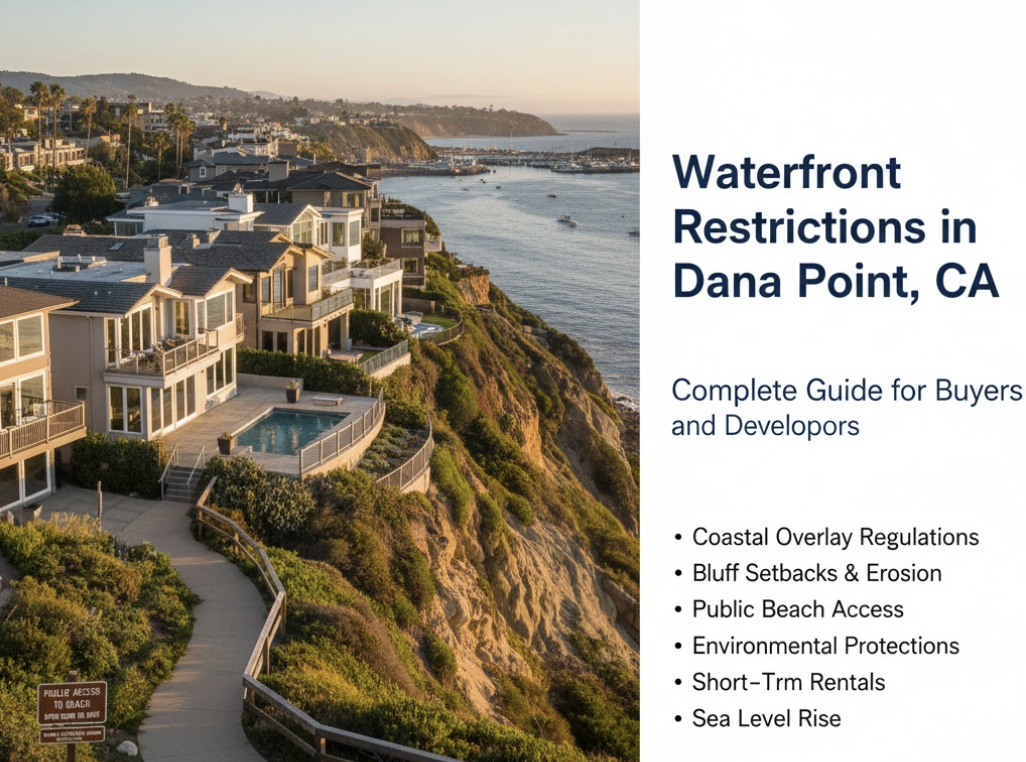
Updated October 2025 • Educational overview for buyers, sellers, investors, and developers evaluating Dana Point coastal property.
Understanding Coastal Overlay Regulations
Waterfront properties in Dana Point fall within the Coastal Overlay District, where all development requires a Coastal Development Permit (CDP) in addition to standard city permits. The California Coastal Act and Dana Point's Local Coastal Program establish an intricate framework protecting coastal resources, ensuring public beach access, and mitigating environmental hazards. Property owners must navigate multiple regulatory layers—city zoning, state coastal policies, and federal environmental standards—before undertaking any construction, renovation, or significant landscape modification near the water.
Important Disclaimer: Educational Overview Only
This guide provides an educational overview of Dana Point's coastal regulatory landscape from a real estate market perspective. It is not legal advice, and it should not be relied upon as a substitute for official regulatory authority or professional guidance. Coastal regulations are complex, frequently updated, and subject to interpretation by local, state, and federal agencies.
For actual development projects, property purchases, permit applications, or compliance decisions, readers must:
- Verify key claims against official Dana Point Planning Department resources and the certified Local Coastal Program.
- Consult the actual Local Coastal Program document (on the City’s website) for exact regulatory language and current requirements.
- Engage a California real estate attorney licensed to practice coastal law for legal questions and compliance advice.
- Work with a qualified coastal planning or environmental consultant for project-specific issues, geotechnical assessments, and permit strategy.
- Contact the Dana Point Planning Division directly at 949-248-3530 for current requirements, application procedures, policy changes, and fee schedules.
Regulatory Environment Note: Information in this guide reflects the regulatory environment as of October 2025. Regulations, fee structures, permit requirements, policy interpretations, and enforcement practices change over time and are subject to updates by the City and California Coastal Commission. Verify all information with official sources before making decisions.
Key Coastal Development Requirements
What is a Coastal Development Permit?
A Coastal Development Permit functions as the primary approval mechanism for any “development” in Dana Point's coastal zone, broadly defined to include new construction, significant remodels, grading, and landscape alterations. The CDP application fee is $1,633, with the Planning Commission conducting a public hearing and determining compliance with the Local Coastal Program. Decisions can be appealed to the California Coastal Commission—a critical step for projects near the shoreline, on bluffs, or within 300 feet of a beach or stream.
Even emergency repairs, such as urgent bluff stabilization following coastal storms, require an initial emergency permit with mandatory follow-up CDP review. This means waterfront property owners cannot simply hire contractors for emergency work without triggering the full coastal permitting process.
Coastal Overlay District Standards
The Coastal Overlay District's intent is to preserve coastal resources and ensure development conforms to Coastal Act policies and the city's Land Use Plan. Importantly, coastal overlay standards take precedence over other zoning rules if more protective of coastal resources or public access. This hierarchy means that general residential zoning cannot override coastal resource protections—a distinction critical for buyers and developers to understand.
The California Coastal Commission retains oversight authority. For properties in appeal zones (typically within 300 feet of the beach, bluffs, or streams), even approved local CDPs can be appealed to the Commission. Certain tidelands areas remain under direct Coastal Commission permitting jurisdiction, adding an extra layer of review for waterfront projects.
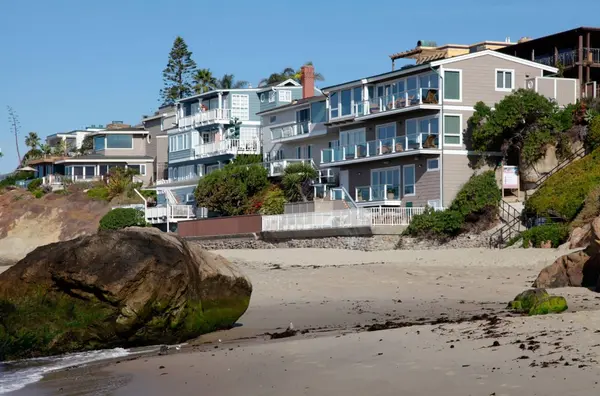
Coastal Bluff Setbacks and Erosion Protection
Minimum Setback Requirements
Coastal bluff properties face the most stringent development restrictions in Dana Point. The minimum setback from the bluff edge cannot be less than 25 feet or must accommodate 50 years of projected erosion—whichever is greater. In practice, geotechnical analyses often indicate significantly larger setbacks than 25 feet to account for site-specific erosion rates and soil conditions.
A geotechnical report prepared by a State Licensed Certified Engineering Geologist is mandatory for any project near a bluff edge. This report must be prepared within one year of the application and must include current bluff edge delineation, soil and geological analysis, and erosion projections extending at least 50 years into the future. The city cannot approve reduced setbacks below 25 feet or below the 50-year erosion line under any circumstance—safety is paramount.
Restrictions Within the Bluff Setback Zone
Even when a structure is built landward of the required setback, the setback area itself is treated as a protective buffer where development is heavily restricted. Only minor improvements that do not threaten bluff integrity are allowed, including low-impact features such as fences, retaining walls, and drought-tolerant landscaping.
Swimming pools and in-ground spas are explicitly prohibited within the bluff-edge setback area, as their weight and associated water could destabilize bluffs. Any minor improvement in this zone requires both a CDP and geotechnical sign-off confirming no compromise to bluff stability.
Landscaping and Water Management
Dana Point mandates that landscaping on bluff properties must be native or drought-tolerant to minimize irrigation. Water-intensive plants and heavy watering near bluff edges are banned to reduce slide risk and erosion acceleration. The city also requires that all surface and subsurface runoff be directed away from the bluff toward a public street or approved drainage system—never directly causing erosion that accelerates bluff failure.
For property owners considering downsizing in Dana Point or buying coastal real estate from out of state, understanding these landscaping restrictions is essential, as violations can trigger code enforcement action and costly remediation.
Building Height and Visual Resource Protection
Height Limitations by Zone
Dana Point enforces building height restrictions designed to preserve coastal views and maintain community character. In most coastal residential zones, development cannot exceed 35 feet in height. In the Beach Road area (Capistrano Beach), specialized zones include Residential Beach Road 12 (RBR 12) and Residential Beach Road Duplex 18 (RBRD 18), which limit height to 28 feet (approximately two stories).
Exceptions to height limitations are possible only when demonstrating: (1) significant coastal public views are protected and enhanced, (2) adequate boating facilities are provided, (3) public access to water-related facilities is maintained, (4) design features promote a village atmosphere, and (5) elevated public viewing areas of the waterfront are provided.
Scenic View Protection Requirements
Scenic view protection is a foundational concern in coastal permit review. Projects must avoid unreasonable blockage of public coastal views per Local Coastal Program visual resource policies. Landscaping on bluffs must be maintained to ensure it does not obstruct public views. This restriction extends to architectural design—buildings must be sited and configured to preserve sight lines to the ocean from public roads and viewpoints.
When evaluating Dana Point's best neighborhoods in 2025, prospective buyers should recognize that properties with superior ocean views face increased regulatory scrutiny to preserve those views for the broader public benefit.
Coastal Flood Hazard Regulations
FEMA Flood Zone Compliance
Much of Dana Point's beachfront, including Capistrano Beach's Beach Road and portions of the Doheny Beach area, lies within FEMA-designated flood zones, including coastal high-hazard (V/VE) zones subject to wave action. The city's Floodplain Overlay District (FP overlay) imposes special building standards in these areas. The FP-3 Overlay applies to coastal high-hazard zones marked as “V” or “VE” on flood maps.
Within FP-3 zones, new construction or substantial improvements must adhere to FEMA-compliant floodproofing and elevation requirements. This typically means elevating habitable floors above base flood elevation, using breakaway walls or open piling foundations that allow waves to pass under structures. These measures can significantly alter building design and increase construction costs.
Prohibited Uses in Flood Zones
The code explicitly prohibits storage of hazardous or explosive materials in coastal high-hazard flood zones and forbids new mobile homes in floodways. Filling or grading that would redirect flood waters is restricted. Any waterfront home must be engineered to withstand coastal flooding and must not worsen flood risks to adjacent properties or the broader community.
Homeowners purchasing or refinancing properties in flood zones should budget for flood insurance and understand that future climate adaptation policies may require structural modifications. The city's ongoing sea level rise planning directly affects long-term property insurability and development potential.
Environmental Habitat Protection
Environmentally Sensitive Habitat Areas (ESHA)
Any designated ESHA—such as coastal sage scrub habitat on a bluff, tidepool areas, or rare species habitats—receives maximum protection. Development within an ESHA is largely prohibited; only uses dependent on the resource (such as nature trails or habitat restoration) are permitted. Building a residence or non-essential structure in an ESHA is forbidden.
Developments adjacent to ESHA must be sited and designed to prevent significant disruption to habitat values. This requires setbacks or buffers from habitat, shielding of lights to prevent disorientation of marine species, and careful runoff control to protect water quality within sensitive areas.
Wetlands and Stream Protection
Dana Point requires a minimum 100-foot buffer around all identified coastal wetlands for any adjacent development. Within this buffer, only very limited uses are permitted—such as passive recreational trails or necessary flood control devices—and only if they will not significantly impact the wetland's ecosystem.
Buffers must include fencing or natural barriers to prevent human and pet intrusion, minimize noise and lighting near the wetland, and use native vegetation to provide transition habitat. A reduced buffer can only be considered if both the California Department of Fish & Wildlife and U.S. Fish & Wildlife Service concur in writing that a smaller buffer will fully protect the wetland—a high bar designed to ensure expert ecological input.
Filling or dredging of wetlands or open coastal waters is generally prohibited, with narrow exceptions for restoration projects, some boating facilities in degraded wetlands, maintenance dredging of harbors, or coastal-dependent uses where no less damaging alternative exists. Any permitted activity must include feasible mitigation, such as creating or restoring wetlands elsewhere to offset impacts.
Public Beach Access Easements
The California Coastal Act's Public Access Mandate
California law mandates that new development shall not interfere with public access and, in many cases, must provide improved access to the shoreline. Dana Point's Local Coastal Program contains a specific public access component implementing these mandates. The California Constitution itself guarantees public access to navigable waters, a principle the city's regulations implement at the local level.
Vertical and Lateral Access Dedications
“Vertical” access refers to pathways from the road down to the shoreline, while “lateral” access means along the shoreline parallel to the water. For certain qualifying new developments, the city requires an offer-to-dedicate a public access easement as a condition of approval.
An access dedication is typically required if a project: (1) is on a parcel identified in the Local Coastal Program or zoning maps as a future accessway location, (2) sits between the nearest public road and the sea, (3) is on a site with substantial evidence of public use of access across it, or (4) is a development that impacts public recreational use such that on-site access would mitigate that impact.
When an accessway is required, a vertical access easement must extend from the public road to the mean high tide line (or bluff edge) and be at least 10 feet wide, conferring a permanent public right of access. The easement is typically offered to a public agency or nonprofit to accept and manage until formal dedication occurs.
Existing Access Protections
New development cannot encroach on or block existing public beach access routes. If a property has historically been used by the public to reach the beach, the development review must address this with findings that the project will not adversely affect public access. If adverse effects exist, mitigation in the form of access improvements is required.
Property owners considering selling their Dana Point home should disclose any existing public access easements or trails crossing their property, as these are permanent obligations that transfer to subsequent owners.
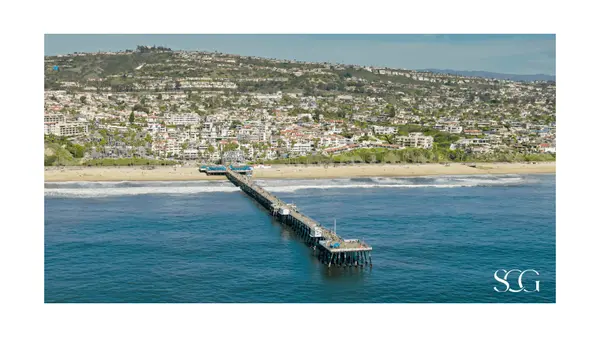
Dana Point Harbor District Regulations
Harbor Zoning and Coastal-Dependent Uses
The Dana Point Harbor area is governed by specialized zoning and a Local Coastal Program segment known as the Dana Point Harbor District. This area, largely on public tidelands, has its own Harbor Revitalization Plan and District Regulations integrated into the city's zoning code as Chapter 9.25.
Regulations emphasize coastal-dependent and visitor-serving uses, with priority given to marinas, boat facilities, public parks, visitor accommodations, and coastal recreation over private exclusive uses. Any development or changes in the harbor—new docks, marina reconfigurations, hotels, or commercial expansions—must be consistent with the Harbor District Local Coastal Program and require CDPs. Many projects trigger Coastal Commission review to ensure they support public access and priority uses.
Marina Operations and Environmental Standards
The Harbor features over 2,200 boat slips and 493 dry boat-storage spaces within approximately 20.5 acres. Operational standards include strict water-quality protections (no discharge, pumpout requirements, BMPs), limits on live-aboards, and anchoring restrictions (no more than 72 hours within 1,000 yards of beach swimming areas in any 30-day period). These are often incorporated as CDP conditions.
For residents interested in Dana Point Harbor boating opportunities, understanding these environmental protections and operational limits ensures compliance and responsible waterfront stewardship.
Short-Term Rental Restrictions on Waterfront Homes
Permit Requirements and Caps
Dana Point adopted a comprehensive short-term rental ordinance in 2023, approved by the Coastal Commission, establishing a regulated STR program in the coastal zone. Anyone renting a residential dwelling for less than 30 days must obtain a Short-Term Rental Permit from the City. It is unlawful to advertise or operate an STR without this permit.
The ordinance sets a cap of 115 STR permits within the Coastal Zone and another 115 outside the Coastal Zone. Within the coastal zone's 115 STRs, no more than 60 can be “non-primary” STRs (whole-home vacation rentals where the owner doesn't live on-site). Owner-occupied home-stay permits are prioritized and often discounted.
Operational Restrictions
Minimum 2-night stay, occupancy generally limited to 2 guests per bedroom plus 2 additional guests (absolute cap 20), quiet hours 10 p.m.–8 a.m., at least two off-street parking spaces, and a local 24/7 contact. The City monitors and reports program outcomes to the Coastal Commission.
Permit Non-Transferability
STR permits do not transfer upon sale (with limited inheritance exceptions). New owners must apply anew—critical for underwriting any projected STR income. See Dana Point STR ROI analysis.
Shoreline Protective Devices and Managed Retreat
Seawall and Armoring Restrictions
Shoreline protective devices (seawalls, revetments, etc.) are allowed only to protect existing structures or public beaches in imminent danger and only where no feasible alternative exists. Mitigation for sand supply impacts is typically required. New development is expected to be sited and designed without reliance on future armoring; many approvals require waivers of any automatic right to a future seawall.
Sea Level Rise and Climate Adaptation
Dana Point completed a Sea Level Rise Vulnerability Assessment (2019) and is integrating adaptation measures into the LCP: erosion-based setbacks, potential beach nourishment, floodproofing above FEMA minimums, and adaptive triggers. Expect increasingly stringent standards affecting siting, foundations, and disclosures.
Water Quality and Runoff Management
Best Management Practices Requirements
Municipal Code Chapter 15.10 prohibits illicit discharges. Coastal permits condition projects with BMPs (e.g., sediment controls, catch basins, landscape filtration, construction waste management). Bluff standards require routing surface and subsurface runoff away from bluffs to approved systems; where feasible, flows are routed to sanitary sewers rather than storm drains to reduce ocean pollutants.
Salt Creek Ozone Treatment Plant
The Salt Creek Ozone Treatment Plant addresses urban runoff and beach water quality. Violations can result in notices of non-compliance, stop-work orders, and fines. Use contractors experienced in coastal water-quality compliance.
Frequently Asked Questions About Dana Point Waterfront Restrictions
What exactly triggers the need for a Coastal Development Permit in Dana Point?
Any “development” in the Coastal Overlay District requires a CDP: new construction, significant remodels (often >25% exterior walls), grading, excavation, demolition, and substantial landscape alterations. Emergency repairs require an emergency permit and follow-up CDP. When in doubt, call Planning before hiring contractors.
Can I build a private dock in Dana Point?
The coastline is primarily open ocean/surf (no protected bayfront neighborhoods), so private residential docks are not typical. Bluff stairways or small landings are considered development and require a CDP, must minimize landform alteration, and cannot impede public access.
How does sea level rise planning affect my waterfront property value and development potential?
Expect stricter setbacks, higher floodproofing standards, possible elevation/relocation-ready foundations, changing flood-insurance costs, and evolving adaptation policies. Factor these into any living in Dana Point decision.
Making Informed Decisions About Waterfront Property in Dana Point
Navigating Dana Point's waterfront restrictions requires understanding multiple regulatory frameworks: local zoning, the California Coastal Act, the Local Coastal Program, FEMA flood regulations, and ongoing climate adaptation policies. Property owners must secure CDPs, comply with bluff setbacks and erosion standards, accommodate public access requirements, protect environmental habitats, and manage water quality impacts.
For buyers considering moving to Dana Point or waterfront areas, these regulations represent both protections and constraints. For investors evaluating Dana Point real estate, the regulatory environment impacts timelines, costs, and feasibility.
Due diligence: review CDP conditions on similar properties; obtain geotechnical assessments for bluff lots; verify flood-zone designations and insurance; confirm easements/access obligations. When comparing Dana Point vs. Laguna Beach or deciding to rent vs. buy, include realistic regulatory costs.
Important Legal and Professional Guidance Notice
The information provided in this guide is intended solely for educational and informational purposes. It represents a real estate professional's market perspective on Dana Point's coastal regulatory environment and should not be construed as legal advice, regulatory guidance, or a definitive interpretation of Dana Point Municipal Code, the Local Coastal Program, the California Coastal Act, or federal environmental laws.
- Regulatory complexity and variation: Overlapping jurisdiction among the City of Dana Point, California Coastal Commission, U.S. Army Corps of Engineers, California Department of Fish and Wildlife, and others. Requirements vary by site, use, and environmental conditions.
- Frequent changes: Regulations, fees, procedures, and interpretations evolve. Information current as of October 2025 may be superseded by City Council actions, Coastal Commission amendments, state legislation, or court decisions.
- Professional consultation essential: Consult the City Planning Division, a California-licensed coastal attorney, a qualified coastal planning/environmental consultant, and (as applicable) Coastal Commission staff for project-specific guidance.
- No liability assumption: Neither Susan Chase, Compass Real Estate, nor any contributor assumes liability for decisions made based on this guide. Verify all information through official sources before taking action.
Official Resources for Verification and Additional Information
City of Dana Point
- Planning Division: 949-248-3530
- Website: danapoint.org
- Local Coastal Program & Zoning Code: see Planning Department pages
- Coastal Development Permit Applications: Permit Center
California Coastal Commission
- Main Website: coastal.ca.gov
- Local Coastal Programs: coastal.ca.gov/planning/lcp
- Coastal Act Text: California Public Resources Code §§30000–30900
Federal Resources
- FEMA Flood Maps: fema.gov/flood-maps
- U.S. Army Corps of Engineers Permits: usace.army.mil
- U.S. Fish & Wildlife Service: fws.gov
Legal and Professional Associations
- State Bar of California Attorney Referral: calbar.ca.gov
- American Institute of Certified Planners (AICP): planning.org
- Coastal Environmental Rights Foundation: cerf.org
Educational Resources
- Understanding the Coastal Act (CCC): coastal.ca.gov/publiced.html
- California Dept. of Fish & Wildlife – Environmental Review: wildlife.ca.gov
- Surfrider Foundation Coastal Access Guide: surfrider.org
Categories
- All Blogs (121)
- 2026 Harbor & Coast Reports (2)
- Coastal OC Lifestyle (7)
- Guides (10)
- Into the Weekend with Susan (1)
- Living in Dana Point (17)
- Living in Laguna Beach (16)
- Living in Laguna Niguel (13)
- Living in San Clemente (12)
- Living in San Juan Capistrano (14)
- Micro-Market Deep Dives (5)
- Relocation (2)
- Right Sizing Strategy (6)
- Strategic Market Intelligence (18)
Recent Posts


REVIEWS